
Products · Agriculture
Field Boundary Extraction
The parcel layer every other agricultural analysis is built on.
Processing service delivered per area of interest
Overview
Where exactly is each field, as it is actually farmed today?
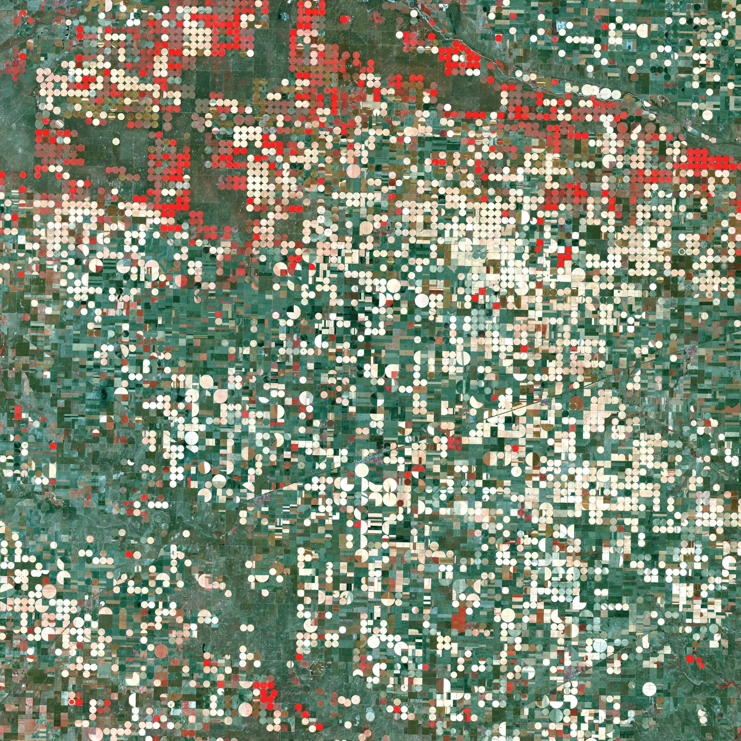
Deep segmentation models extract the exact boundary of every cultivated parcel directly from satellite imagery, independent of cadastral records, so the result reflects the land as it is farmed this season. Vectorisation and geometry clean-up produce closed, clean polygons that become the base layer for crop classification, irrigation mapping and water accounting.
- Deep-learning segmentation
- Method
- No cadastral input required
- Independence
- 10 m standard, sub-metre with high-resolution input
- Resolution
- Clean vector parcels
- Output
Example outputs
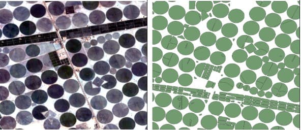
Imagery (left) and extracted parcel polygons (right).
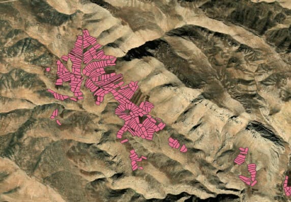
Delineated parcels in mountainous terrain with small, irregular fields.
How it works
Pipeline and maturity of each stage
- 01
Imagery selection
OperationalCloud-free optical scenes across the season, or high-resolution imagery where field sizes demand it, optionally enhanced by super-resolution.
- 02
Segmentation
OperationalA deep-learning model predicts parcel interiors and edges simultaneously, trained on parcel polygons from a range of climates, field sizes and farming patterns.
- 03
Vectorisation and clean-up
OperationalEdges are converted to closed polygons, geometry is regularised and small artefacts removed, producing a topologically clean parcel layer.
- 04
Delivery
OperationalParcel layer with area statistics, updatable each season, delivered as shapefile or GeoJSON with a report.
Data used
- Sentinel-2
- High-resolution optical imagery on request
- Super-resolved imagery for small parcels
Methods and models
- Deep-learning segmentation
- Edge and region prediction
- Vectorisation and geometric regularisation
Outputs
- Parcel boundaries (shapefile / GeoJSON)
- Parcel area statistics
- Seasonal update of the layer
Who it is for
- Cadastre and land administration
- Agricultural statistics and subsidy control
- Irrigation scheme management
- Input layer for crop and water products
More in Agriculture
All agriculture products- Crop type classification
- Rainfed / irrigated classification
- Agricultural water accounting
- Cultivated-area mappingProcessing service
- Crop condition and stressProcessing service
- Irrigation water demandIn development

From space. For Earth.
Start with ARASAT
Tell us what you need to monitor, understand or protect. Our team works with you from the first conversation to a running program.